


|
|
|
Lakia-Jukola_map_Kauhava_jun24_IMG_053828c |
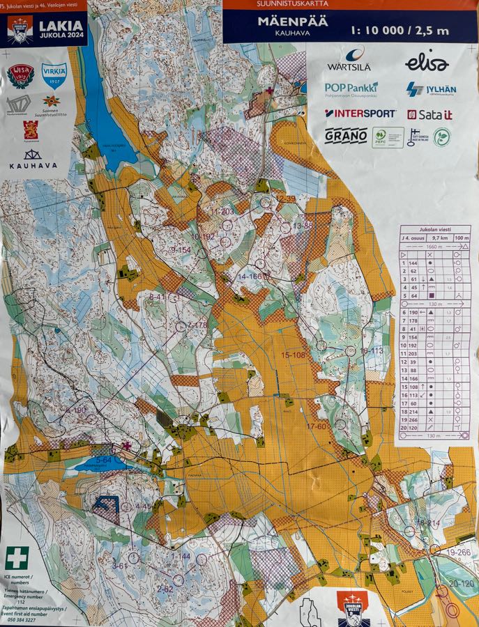
The map, with leg 4. The start/finish area was quite a distance from the best forest areas, so there was a 1.6 km transport stretch to the start triangle. The terrain was otherwise good technical orienteering, if a little “green” in places (orienteering jargon for dense vegetation and low visibility).
Page: 19 of 23 (82%)